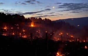
Are you in Montalcino or are you planning a trip to the most famous wine area in Tuscany? Do you love walking or running in the outdoors? Today, I want to tell you about the top 3 hiking trails around Montalcino.
I love walking. In the last 15 years, I have explored the paths and dirt roads of Montalcino far and wide both alone during my runs and with friends and customers from all over the world, so I would like to share with you my selection of the 3 best trails to walk or run around Montalcino. Let’s start!
- FROM MONTALCINO TO SANT’ANTIMO
- THE NORTH FACE OF MONTALCINO
- THE SOUTH WEST SLOPE OF BRUNELLO
From Montalcino to Sant’Antimo
- Length: 10 km (6 mi)
- Elevation: +200 m, -400m (+650 ft, -1.300 ft)
- Time: 2 hours easy walking

This is certainly the most famous hiking route in the entire Brunello di Montalcino area.
From the old town of Montalcino, we head south along the ancient walls and through vegetable gardens and olive groves until we reach the woods, which, in the cool shade of its chestnut trees and centuries-old oaks and on its soft bed of fallen leaves, lead us to the ancient archaeological site of Poggio Civitella, the highest point in the territory of Montalcino and strategic observation point for the ancient Etruscans who were the first to colonize these hills.
Up here, the perspective changes: from the cool, shady and whispering belly of the arcane voices of the wood to the full blazing light of the southern sun that now kisses us on the forehead and guides us along this beautiful dirt road. A main dirt road, slightly downhill, which heads straight to the magnificence of the Amiata, an ancient volcano and sacred mountain of the Etruscan people.
With its distinct volcano shape, Monte Amiata stands out and seems like a good giant that protects the Brunello territory from storms that may approach from the nearby Mediterranean Sea. Our legs easily take step after step as if magnetized by the powerful attractive force of the Amiata that watches over us and calls us to come closer.
Climate change has forced the vines to be moved up here at the limit of 600m altitude where it was considered difficult to ripen Sangiovese even in the 1980s. A vigneron’s challenge now is to plant their vineyards at a higher altitude in order to escape the oppressive summer heat.

Here, we are really on the rooftop of Montalcino: our gaze can sweep freely all around. Over there to the east, we can let our eyes look over the magnificence of the Val d’Orcia with its rolling hills and its tidy fields of a thousand shades of ocher, yellow and green. To the west, the infinite vineyards of Brunello vie for their place with the green forests of the region. To the south, the mountains that call and welcome us in their promise of verticality.
The spring in our step takes us south, slightly downhill. We feel free and light, we are in a bubble above everything. But it is a moment of perfection and euphoria that soon leads us back to the woods and to the path that now becomes steep, bumpy and demanding. The panorama changes again giving us glimpses of the Starcia Valley through the branches that culminates in the voluptuous hills of the village of Castelnuovo dell’Abate and the Abbey of Sant’Antimo, our destination draws near with each step.
At the bottom of the steep, hard and stony side of the hill, our feet finally step onto the soft tuff sand, and we are rewarded for our efforts with one of the most fascinating and mysterious buildings in all of Tuscany which appears right in front of us: the Abbey of Sant ‘Antimo surrounded by century-old olive trees, soft meadows and Brunello di Montalcino vineyards.
The North Face of Montalcino
- Length: 10 km (6 mi)
- Elevation: +350 m, -350m (+1.100 ft, -1.100 ft)
- Time: 2 hours easy walking

Starting again from the historic center of Montalcino, you can dive into a completely different world by heading north along a ring trail that leads us to discover the magical hill of Montosoli with its famous vineyards and the more arid and sunny Deserti area to finally return up the steep Canalicchio.
Porta Burelli is a magical arch, a portal that immediately takes you down the steep and fast descent through the so-called Canali while being protected by the shade of the chestnut trees as well as by the side of the hill upon which the town stands. The view towards the North is splendid: Siena in the distance, the Crete Senesi with their lunar hills, the woods of the Colline Metallifere that fade towards the northwest and the dozens of small farms with their plots of vineyards and olive trees just below us. All so clear that it almost seems as if we can reach out with one hand and touch it.
But this vision lasts just for a moment because the road is steep and it beckons us to the bottom of the hill. Here begins the gentle winding of the dirt road that cuts between the vineyards and the Montosoli hill until we reach the wide spaces of the Deserti where things get bigger and indistinct and the eye runs fearlessly along the contours of these clay hills until it wanders away on the horizon.
Montalcino looks down on us from above and guides us towards the northeast to take a stretch of the Via Francigena, the famous road across Europe that saw the pilgrims of the past start from Canterbury (GB) to make their way down to the Rome of the Popes.

Here, we perceive the charm of the Great Road: it vibrates quietly under the white gravel, we hear its rhythmic beat from the billions of steps that have trodden on it over the centuries. We are bewitched by the vibrant flow that speaks to us of modern walkers, called from all over the world to challenge themselves along the Francigena. We feel part of this great story of people on pilgrimage and the temptation is to give in to the song of the siren that whispers to us to continue south. But this is another story that is not ours today, one which will soon be worth telling…
And here we are then, taking the direction of the vineyards. Up there, Montalcino calls to us and tells us its story of today, of orderly rows of vineyards that we cross with inebriated steps, of harvests and pruning, of exciting vintages and of great wines. And it is by listening to these stories that we find ourselves at the foot of the Montalcino hill which, with its steep slope, challenges us to conquer it once again.
We are at the bottom of the Canalicchio, one of the most famous wine areas of the whole Brunello Terroir. It seems impossible to make it up the hill, but along this steep stretch, with its dry stone walls, stone farm houses and small plots of vineyards and olive trees, there is something special that makes us feel light and carries us upwards almost without even realizing it. And this is how, in just one breath, we burn up the last 200 meters of altitude difference on this ring walk until we return to Porta Burelli. And the dream that suddenly vanishes is imprinted forever in our memories: it is the dream of the north side of Montalcino.
The South West Slope of Brunello
- Length: 13 km (6 mi)
- Elevation: +400 m, -400m (+1.300 ft, -1.300 ft)
- Time: 2,5 hours easy walking

Montalcino is an immense territory of over 250 square km. This circular hiking trail allows us to experience the atmosphere of one of the hottest and sunniest areas of the Brunello terroir. Sant’Angelo in Colle is the hamlet of Montalcino where we will start and end our wandering through the vineyards.
Among other things, Sant’Angelo in Colle means Col d’Orcia, Poggione, Ricci: three well-known wineries that have made history in the past and that guide that history of this small Tuscan village in the present. It is through their woods, olive groves, vineyards and farms that this path mainly winds, initially on the dirt road that descends towards the Poggione cellar but which we soon abandon to step into a maze of paths, old mule tracks and uncertain trails in the fields that only the few remaining town elders can speak of.
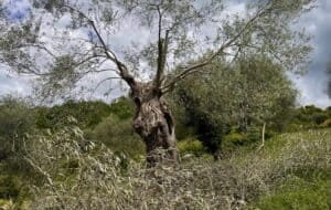
The descent takes us through dilapidated farms to the famous Quercia dei Discorsi, a giant oak tree whose branches shielded secret love affairs over the centuries and which now listens to the chatter of agricultural workers on their lunch breaks today.
We are in the middle of some of the most famous vineyards in the world, not far from the Orcia River which marks the southern border of the Brunello di Montalcino terroir. The sparkling Tuscan light is the host, and we feel part of this unique landscape maintained over the centuries by the tireless work of man’s hand.

Slowly we move eastwards, continuing to alternate stretches on dirt roads with others in the thick of the woods. We go up and down the hill experiencing the daily toil that generations of farmers have poured into every corner of these fields in our own legs.
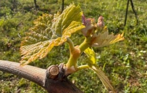
In autumn, the forest will give us delicious juicy red corbezzoli, big wild berries that relieve our fatigue and reward us with their mysterious flavor somewhere between sweet, bitter, and sour. Or, in summer, we can dare to taste some Sangiovese grapes to verify their ripeness and perhaps predict if it will be a good year or not for Brunello.
Finally, we come out in the middle of Strada di Sesta, the main dirt road that connects Sant’Angelo in Colle and Castelnuovo dell’Abate, the two best known hamlets of Montalcino. Along its sinuous curves we return to the starting point. The village of Sant’Angelo with its unforgettable charm beckons us from above to return. After a gentle climb for a few kilometres, we close the ring that we traced through the vineyards on the southwest slope of the Brunello territory.
Info, guides and gps tracks

Contact us if you want to receive more info about these and other trails around Montalcino and the Val d’Orcia.
We can organize your walking or running holidays with or without the full support of minivan, hiking guide, luggage transfer, picnic, winery visits … or send us an email just to get the gps tracks and do some chats 🙂